You’ve heard the saying, “Good data in, good data out. Bad data in, bad data out.” For fishermen, that means “Good map, good fishing. Bad map …” Well, you get the idea.
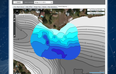
A bad map is the result of bad data. And many available fishing maps were built from bad data. That makes them … well, not good. Not nearly as good as you might have thought they were. Insight Genesis maps, however, show contours and fish-holding bottom structure based on good data – data you collect by recording and uploading your own sonar logs.
A few things are really important for making the most accurate maps for fishing:
- Tightly spaced up-and-back survey tracks
- Optimum transducer placement and operation
- Data review and removal of bad data points
You control the first two factors. The Insight Genesis Quality Control Team’s got your back on the third.
If spacing between survey tracks is too wide, some depths between them will be estimated. This is true of any computerized mapping program. But too much estimation results in maps that miss key fish-holding bottom structure. Many commercial maps were created from data collected on boats that made survey tracks spaced two hundred or more feet apart.
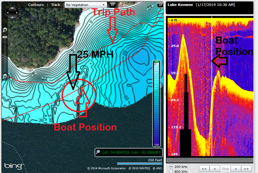
Insight Genesis uses checks and sophisticated algorithms to confirm that every piece of data used to create Genesis maps pass quality control. And the manner in which Genesis matches boat position with sonar view allows you to confirm good data and allows Lowrance support to confirm good transducer placement and signal. The image below shows an example of bad data that was removed automatically by the Genesis system.
Transducer placement wasn’t necessarily bad in the example above, but when the boat kicked up to 25 mph to move to another spot, the transducer slanted in such an angle that the unit read much deeper than actual bottom. If this data wasn’t scrubbed by Insight Genesis, the map made from the sonar log that recorded it would portray some inaccurate depths. But Genesis caught the inaccurate data and threw it out, ensuring that the map was sound. Genesis’ top priority is ensuring the highest data integrity and the best maps for catching more fish.
Now that’s a revolution in map making. That’s the Insight Genesis revolution.
If you have screenshots that can help the Genesis community better understand transducer placement and mapping practices, post them to the Insight Genesis Facebook page. We’ll learn from each other, as a community.
For more information about Insight Genesis, watch the video below and visit the website at https://insightstore.navico.com/insightgenesis.

