 Finding and catching fish just became easier for C-MAP Genesis Edge customers. Bottom-hardness map layers are available now — via download from Social Map — for all premium Genesis subscribers, without additional cost.
Following the release of C-MAP’s new Social Map bottom-hardness layer, Genesis Edge subscribers will no longer have to survey a waterbody entirely by themselves in order to get a bottom-hardness map with 1-foot-contours. Bottom-hardness layers for thousands of highly detailed, community-sourced contour charts are now available to Genesis Edge customers with no more effort than the click of a button.
Why is knowing bottom hardness important?
They say 90% of the fish are in 10% of any waterbody, quite often around rocky areas, where they hold, feed and breed. So if you want to increase your chances of catching more and bigger fish, knowing where to find them is key. 1-foot contours are a step in the right direction, but bottom hardness data points to the most-productive spot-on-the-spot areas.
 What will you be able to see?
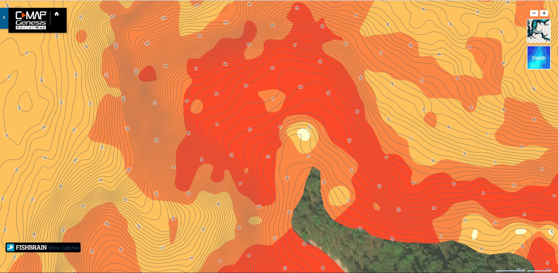
A bottom-hardness map layer, overlaid atop a C-MAP Genesis-created 1-foot-contour chart, helps anglers more easily and quickly locate fish-holding rock, gravel, sand, clay and shellbeds. Dark orange areas show the hardest bottom; a lighter orange indicates the next-hardest bottom; tan is the next-hardest bottom; and pale yellow shows the softest-bottom areas. Your contour lines will be visible through the bottom-hardness layer, so it will be easy to see at what depth the transition areas are located
How do you get the Social Bottom Composition Layer?
Easy! Subscribe to C-MAP Genesis EDGE for $99 a year or $24.99 a month.
Additional Genesis Edge subscription features include:
– Submerged-vegetation layer for custom maps
– Sonar re-play
– Minute-to-minute weather information archived in sonar data
– Option to keep private any areas personally mapped
– Fishbrain catches overlayed atop online Social Map charts
Note: Upon insertion into a compatible Lowrance sonar/GPS unit, a C-MAP chart containing a bottom-hardness layer will default to showing that layer upon start-up. Steps to turn off (or later, back on) the bottom-hardness layer (it will be called “(AREA) Vegetation/Composition” in the menu) are:

