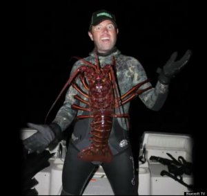
Imagine the huge bass you’d catch with this giant craw trailer!

Giant_LobsterOK, so that’s not really a craw, it’s a lobster – a giant one! But just imagine how giant the bass would be that could crush a crustacean bait that big. Talk about a lunker!

The giant lobster in the photo weighs nearly 12 pounds and is estimated to be a whopping 70 years old, reports the Huffington Post. Biologist Forrest Galante, 26, caught the extra-large lobster while freediving near Anacapa Island on Oct. 6, according to the report.

Just as lobsters and crawfish (crayfish, crawdads, mud bugs, etc) look similar, they share another trait too — they live on and around offshore hard-bottom areas. That’s a big part of why “a bass loves a hard spot,” as explained by 2014 Bassmaster Angler of the Year Greg Hackney, who uses Lowrance electronics to help find and catch giants and win tournaments. (Caught any giants yourself? Post your photos on the Insight Genesis Facebook page!)

We can’t say for sure how Galante found the spot where the giant lobster lived, but we’re confident that you can find offshore hard-bottom areas where big bass are likely to bite a craw-imitating bait by using an Insight Genesis custom contour map in conjunction with your Lowrance StructureScan and 2D sonar. Continue reading “Imagine the huge bass you’d catch with this giant craw trailer!”

Use Insight Genesis maps on your mobile phone or e-tablet!

iPhone with map
Photo illustration

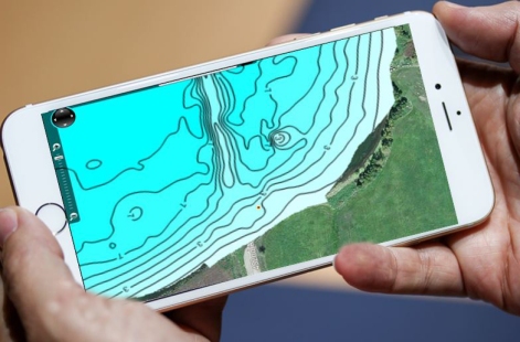
Need another reason to buy the new giant iPhone? You can view your Insight Genesis custom contour maps on it!

Insight Genesis, the innovative cloud-based map-generation tool for Lowrance, Simrad NS and B&G Zeus series chartplotters, is now enabled for use on mobile phones and e-tablets. With the release of a new HTML5-powered viewer, custom Insight Genesis maps and Insight Genesis Social Map charts can now be viewed on iOS, Android, Windows and mobile phones and tablets. In regions with good cellular service, the upgrade will allow free viewing of Genesis maps from your boat, while on the water.*

HTML5 is programming language used for structuring and presenting content on the Internet. Insight Genesis’ new HTML5 architecture replaces a system based on Silverlight, which was not compatible with mobile devices. To view your custom Insight Genesis maps and Social Map charts on your mobile device, log in to your account and click on a lake name, just as you would on your computer. Continue reading “Use Insight Genesis maps on your mobile phone or e-tablet!”

“Hump of the Week” on a small Ark. lake mapped by The Pond Pro

PondPro_ZOOM_HumpDay-9-17-14Do you fish smaller, off-the-grid lakes with bad maps — or no maps at all? Map them yourselves with Insight Genesis to find un-pressured fish-holding structure. You’ll catch more and bigger fish if you do, says small-water specialist Tim Shannon, AKA The Pond Pro.

“I am blown away at the structure I was missing without Insight Genesis,” Tim says. “I mapped a very small section of [an area lake] and have already found one major hump I never knew existed. If you’re not using Insight Genesis yet it’s time to get on board.”

Tim’s screenshot of that previously unknown fish-holding structure is our inaugural Insight Genesis Hump Day Hump of the Week. Have you used Insight Genesis to locate fish-holding structure not shown previously on any other fishing map? Post a screen shot on the Insight Genesis Facebook page and we might feature YOU in our next Hunp of the Week spotlight. (Click “Continue Reading” to see larger screen shots and learn more) Continue reading ““Hump of the Week” on a small Ark. lake mapped by The Pond Pro”